
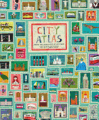
Istanbul, Berlin, San Francisco, Amsterdam, Mumbai, Budapest, Hong Kong and Cape Town are just a smattering of the 30 world cities represented in the playful, kid-friendly and, unless you are made of stone, travel-inspiring City Atlas, first published in the U.K.
Readers are invited to lose themselves in these fascinating, history-rich cities, gorgeously showcased in abstracted double-page maps teeming with whimsical cut-paper-collage-style illustrations of people, animals, buildings, food, art, traditional garments, vehicles, historic sites and tourist attractions. Each intriguing icon is labeled with a very short caption identifying local must-dos: in Lisbon, "Go crazy for Portuguese CUSTARD TARTS"; in Amsterdam "See Anne Frank's secret annex during World War II at the ANNE FRANK HUIS"; or, in Chicago, "Go on a nighttime aquatic adventure at the SHEDD AQUARIUM." The search-and-find challenge (find five painted blue skulls in Mexico City, five lucky dragons in Hong Kong, five koala bears in Sydney or five Russian dolls in Moscow) is bound to have young explorers scouring every inch of the dynamic and colorful pages. The mother country of each city is represented by a picture of the national flag, its population and primary language, and a flag-waving person is always somewhere to be found saying "hello" in one of that city's spoken languages.
Readers will want to drop the book and jump on a plane to see Frank Gehry's giant goldfish sculpture in Barcelona, play telephone at St. Paul's Whispering Gallery in London or explore the star-shaped Kastellet sea fortress in Copenhagen. Go. Go! --Karin Snelson, children's & YA editor, Shelf Awareness